
Tracing a Union City Street Directory
A street-by-street search works best as a chain, not as a single name search. Union City sits in Hudson County, so municipal records, county parcel records, and recorded instruments have different custodians. Begin with the written street address, but preserve the block and lot once a property tool supplies them. That key lets a searcher compare the parcel across systems even when an older deed uses a legal description or a street label appears in a shortened form.
The chain distinguishes property evidence from person evidence. A visible owner or tax mailing address is not proof that the named party currently lives at the situs. Likewise, a voter lookup is an exact-name check, not a public list of everyone on a block. The useful result is a dated record trail that can be checked with the office that created it.
- Normalize the address. Try the street number, spelling, suffix, historical municipality label, and the postal result before recording a match.
- Use the Union City Tax Department links or New Jersey property tools to locate the parcel. Save the situs, block, lot, property class, and filing or update year.
- Open the Hudson County GIS viewer and compare the mapped parcel with the written address. Inspect nearby parcels only as far as the question requires.
- Search Hudson County AcclaimWeb by legal description, block and lot, address, or a party name. Record the instrument number or book and page before moving backward.
- Follow a prior grantor or grantee only when the legal description matches. A deed chain tracks recorded transfers, not every person who occupied the address.
- Use the state voter route for a named person and only the limited status or assignment information it exposes. Do not treat it as a street roster.
- For an older address, compare a reverse directory, newspaper index, yearbook, and deed. Keep the publication year with each historical entry.
- When a permit or code record is needed, ask the Building Department for the specific address record or use the City Clerk's written OPRA route if it is not published.
Note: Retaining the address, block and lot, instrument number, and source date prevents a dense Union City street grid from turning into a same-address mistake.
Union City Street Directory Record Routes
Address-keyed records are spread among several offices. The tax and assessment route begins locally, the map context is county-managed, and recorded instruments belong with the Hudson County Register of Deeds and Mortgages. City forms can point to a permit or inspection record, but the research found no public searchable Union City permit or code-case database. That absence matters: a published form is not a searchable street index.
| Address record | Custodian | Street-level detail | Access path |
|---|---|---|---|
| Tax assessment | Union City Tax Department and state property tools | Situs, block/lot, assessed values, class, visible owner or mailing data | City links and New Jersey property search |
| Parcel map | Hudson County GIS | Parcel geometry, address attribute, adjacent parcel context | Public viewer and supporting REST layer |
| Recorded instrument | Hudson County Register | Grantor, grantee, recording date, consideration, legal description | AcclaimWeb or search room |
| Voter registration | New Jersey elections and Hudson County | Limited fields from an exact-name lookup | State lookup and county office |
| Permit or code file | Union City Building Department | Address-specific construction, inspection, complaint, or code clues when released | Forms, department request, or OPRA |
| Historical directory | Library of Congress and local history collections | Householder or occupant clue for a published year | Directory holdings and library research |
Use the property key to connect the first three rows. Then use a named person, a publication date, or a narrowly described municipal request to test a separate question. The Hudson County Register keeps computer and hard-copy indexes available in its public search area, an important fallback when the online interface does not answer an older-book, image, or spelling-variant question.
Union City By-Address Parcel Fields
The New Jersey property search and Property Explorer provide the documented property route for a Union City street search. State material describes annual local-assessor data with location or owner information, block and lot, land and building assessed values, prior taxes, and property class. A January filing may not reflect a later change, and owner names can be redacted. The local practical route remains the Tax Department, with Union City assessor district code 0910.
| Field or route | Type | Required | Options or format notes |
|---|---|---|---|
| Address | Text | Search-dependent | Enter street number and name. USPS and municipal labels can differ. |
| County | Select | Optional | Choose Hudson County when the property tool offers a county choice. |
| Municipality | Select | Optional | Choose Union City to keep a county-wide query from mixing nearby municipalities. |
| Block | Text or number | Optional | Use the local tax block with the lot for an exact follow-up. |
| Lot | Text or number | Optional | Pair with the block as the local parcel key. |
| Property Explorer map | Map or search | Optional | Use map and parcel geometry as a cross-check for the written address; exact live controls need browser capture. |
| Property class and values | Displayed data | Not stated | Assessment context, not a current market value or a statement about an occupant. |
The state Property Explorer source is shown below because it is the documented entry point for parcel, block-and-lot, assessed-value, and tax-data context.
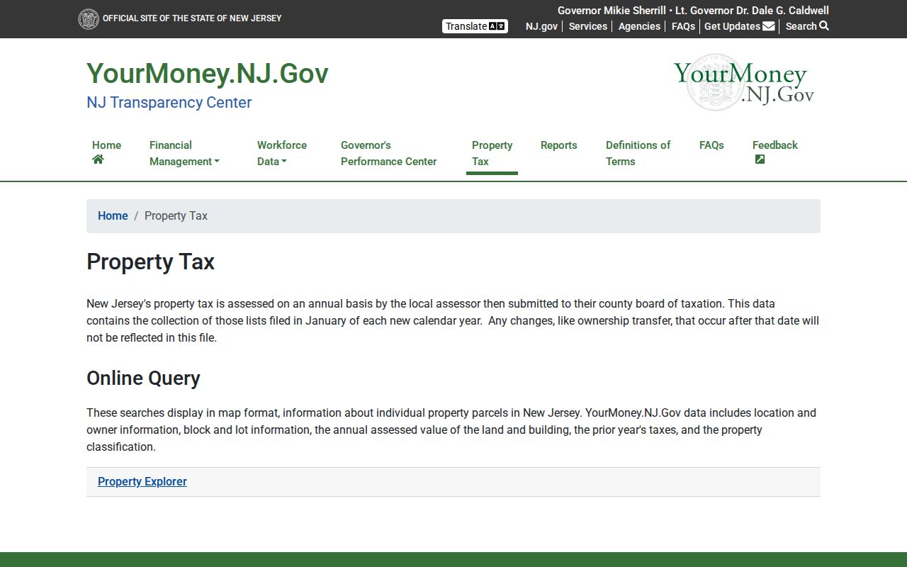
A parcel card can separate the property situs from the tax-bill mailing address. The situs is where the parcel sits. A mailing address only identifies where tax correspondence was sent, so it should not be relabeled as a present residence.
The Union City tax-search route below is the captured district 0910 entry point. Its live field inventory was not fully exposed in the research, so treat the shown route as a starting point and verify any interactive control in the service.
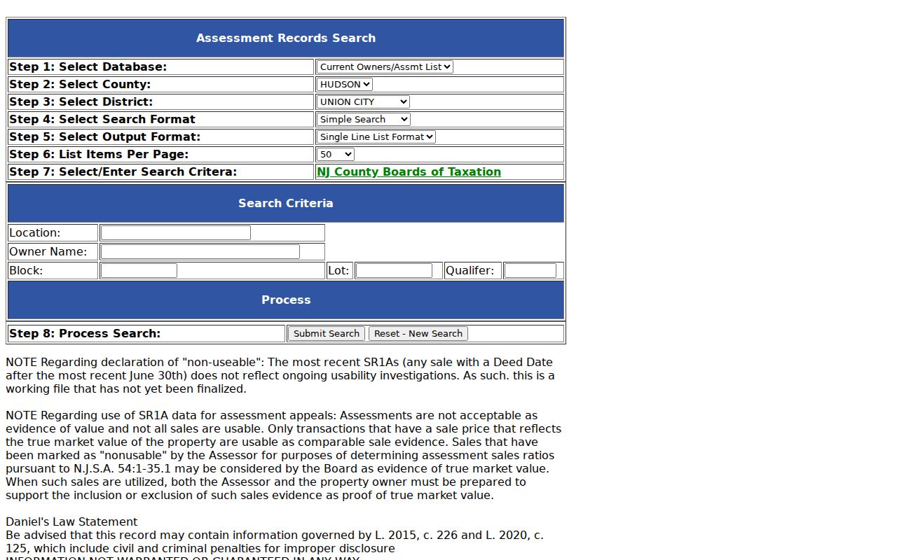
The tax route adds a local assessment path to the state property search. It does not convert a street address or a tax mailing field into proof that a person currently occupies the parcel.
- Parcel
- A mapped unit of land used in tax and property systems, often identified by block and lot.
- Situs address
- The physical location of the parcel, distinct from a tax mailing address.
- Legal description
- The recorded property description used in deeds, sometimes instead of the familiar street address.
- Criss-cross directory
- A historical address listing arranged to help move from a house number and street toward a published household entry.
Union City Street Directory Map Check
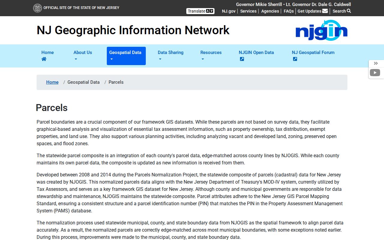
After locating a block and lot, the county map adds parcel shape and street context. The New Jersey parcel-data page documents searches by address, county, municipality, block, and lot, plus its relationship to PAMS parcel identification. It also warns that hosted parcel data can redact owner names under Daniel's Law and that county parcel boundaries may not edge-match across county lines.
The NJGIS parcel-data and Property Explorer source below documents the state parcel route and its update and redaction notes.
Hudson County's live GIS viewer is the local map entry point. Its supporting parcel service exposes a Parcel_Address field. Pan or search to the street, inspect a parcel, and compare visible adjoining parcels with the written property key. The research did not verify the viewer's exact layer names, buffer controls, or owner-link behavior, so those features should be checked in the live map before being relied upon.
The Hudson County GIS viewer source below is the county's official ArcGIS entry point for parcel and map layers.
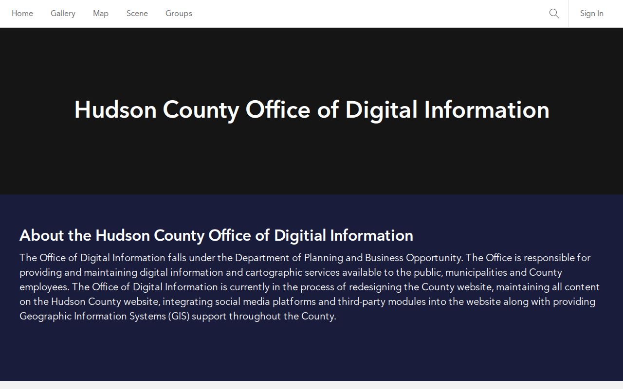
The viewer supplies the local parcel-map setting for a Union City street search. Its observed supporting layer confirms a Parcel_Address field, while individual viewer controls and the full live layer set still require direct confirmation.
Note: A parcel edge and an address attribute help orient a street search, but neither one identifies every person connected with a property.
Union City Street Directory Deed Trail
Recorded instruments give the Union City street directory its strongest ownership trail. AcclaimWeb Official Records Search offers Name, Book/Page, Instrument Number, Legal Description, Document Type, Consideration, and Record Date modes. For an address question, use the legal description or block and lot first, then compare the current grantee and earlier grantor record by record. Keep the document type, recording date, consideration, and instrument number with the matching legal description.
The Hudson County deed-index source below shows the official search interface and the distinct ways an address trail can be queried.
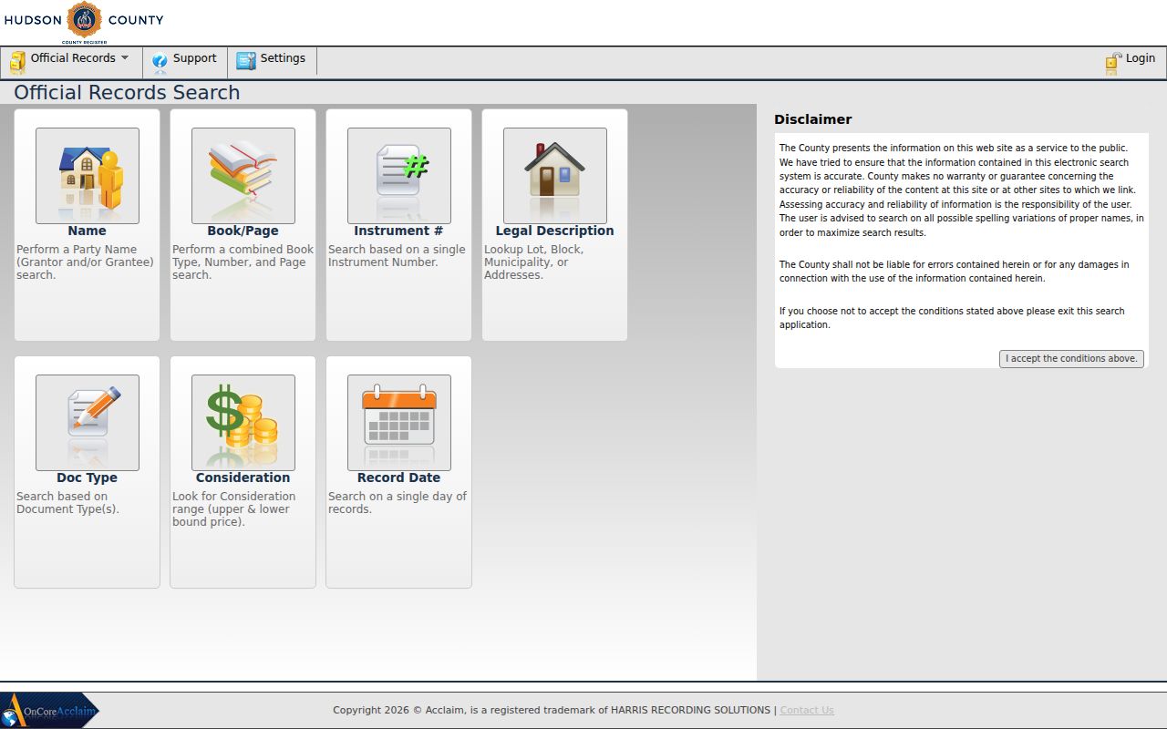
The online coverage start was not found in the reviewed official sources. That is a limit, not evidence that older instruments are absent. The Register's public search area at 257 Cornelison Avenue, 2nd Floor, Jersey City, provides computer and hard-copy indexes Monday through Friday from 9:00 a.m. to 2:00 p.m. The Register lists 201-395-4760 as its main number, with customer service at extensions 2870 and 2886.
When the portal cannot resolve an older book, image, or surname variant, contact the Hudson County Register of Deeds and Mortgages rather than assuming the chain ends online.
Union City Street Labels Before 1925
An older Union City address may be indexed under Union Hill, Town of Union, or West Hoboken. Union City formed from the Town of Union or Union Hill and West Hoboken in 1925. The city's own history gives June 1, 1925 for the consolidation, while a state municipal-history table gives January 1, 1925. Preserve both dates with their sources when a search sits near the change, and do not force a pre-1925 record into the later municipal label.
The research did not locate a verified citywide renumbering project or a renumbering year. A changed number is therefore a question to test through historical municipality names, street-name variants, maps, the City Clerk, Building or Planning staff, county GIS, and library research. It is not a fact to assume. The Dardanelles, Central Avenue, Bergenline Avenue, 23rd Street, Palisade Avenue, Sip Street, and New York and 2nd Avenue are additional location terms documented in city history or planning material.
Union City Street Records at Building
The Union City Building Department publishes construction, inspection, complaint, zoning, variance, demolition, continued-use, and related forms. Those forms can help identify the type of address-specific file to request. The research did not find an official, searchable city permit or code-case database, so a direct inquiry is the documented fallback for a specific street address.
Ask for the exact record, address, and date range rather than a broad person search. If a municipal record is not posted, the City Clerk is the records custodian path through the Union City OPRA request form. New Jersey OPRA requires a written request to the correct custodian, and ordinary state guidance describes a seven-business-day response when a record is available. A request does not override exemptions or require an office to create a new index.
Union City Street Directory History
For a past household clue, the Library of Congress street-address directory guide confirms Union City holdings for 1946, 1954, and 1956 through 1958. Start with the house number, read the entry and its abbreviation key, then compare adjacent numbers and cross streets. A directory can anchor a person or business to its publication year, but it does not establish a current connection to the address.
Pair a historical address entry with a deed, newspaper, or other dated source before treating it as a property trail. The historical volumes themselves are covered in greater depth in the Union City city directory collections, where year runs and companion sources can be compared without turning a modern street search into a broad historical shelf.
Union City Deed Alert Quirk
Hudson County's free Recording Notification Service is useful only after registration. It asks for an email and identifying name information, and the county advises entering exact names plus spelling and business-name variants. Alerts apply to documents recorded after signup. They do not search backward through the street's older deed history.
This makes RNS a future-monitoring tool, not a substitute for AcclaimWeb or the Register's search room. The county also advises that submitted names and email addresses are public under the notice on the registration page. Use the service only when that disclosure makes sense for the individual registering.
Union City Street Directory and 07087
For a Union City street address, USPS is a delivery check rather than the final property authority. The primary local ZIP is 07087. Use the USPS address-to-ZIP lookup with the full number and street, then compare its result with the Union City parcel situs and the municipality value in a deed or tax record. This three-way check helps separate a postal label from a property description.
The Union City Post Office is at 301 30th Street, and USPS lists Bergenline and Forty Fifth Street stations under 07087 suffixes. Weehawken's 07086 and West New York's 07093 are nearby postal labels. Neither should be treated as Union City delivery without the exact address result. USPS ZIP+4 is a delivery detail, not a legal boundary or evidence of who occupies an address.
Limits of a Union City Street Directory
A street record can identify a parcel, a recorded party, or a publication-era household clue. It cannot prove every current occupant. Utility customer lists, private delivery records, DMV address data, unlisted household members, and protected addresses are not public alternatives. New Jersey's voter route is a person-specific lookup, and the research found no general public function for listing a street's complete set of registered voters.
Address visibility can also be limited by the New Jersey Address Confidentiality Program and Daniel's Law. A missing name or address can reflect lawful suppression rather than an empty parcel or failed search. Stop after the public record answers the specific personal, family-history, property, estate, or civic question, and confirm consequential details with the office that holds the record.
Lawful use. Use Union City street and address records for a lawful, specific purpose. Do not use a record trail to stalk, harass, intimidate, or expose a protected address.